The bus picked us up 7:15am and we reached the start of Tongariro Alpine Crossing about 35 minutes later. The weather were perfect and just calm winds. No need for a jacket when walking, but a shirt only. The track is 19,4 kilometres and takes about 7-8 hours to walk. The start is about 800 metres above sea level and the highest point of the crossing is about 1960 metres. To cut a long story short, the walk were just amazing and unforgettable, even though my legs says something else at the moment. I think the sample of photos below depicts what words can't describe.
 |
| Sunrise at Mordor (e.g. Tongariro). Mount Ngauruhoe is visible to the left. |
 |
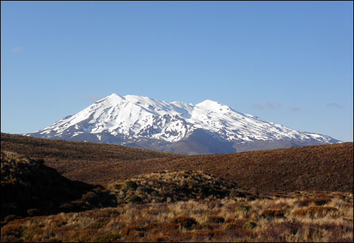
| Mount Ruapehu, which reach 2971 metres above sea level. |
 |
| Mordor and Mount Doom (Mount Ngauruhoe). The track is visible at the base and crossing the plain towards left. |
 |
| Interesting colours near the Tongariro summit. |
 |
| View from the Tongariro ridge. The Blue Lake in background and the Emerald Lakes lower to the right. |
 |
| The beautiful Emerald Lakes. |
 |
| The walk downwards at the second part. Lake Rotoiara in background. |
 |
| New Zealand Pipit, which were the only bird species seen on higher altitudes. |
 | ||
A lovely stream in the woodlands before the finish of the walk.
|


1 comment:
Fantastic landscapes! It looks as you have started off well.
Take care / Ulf
Post a Comment